
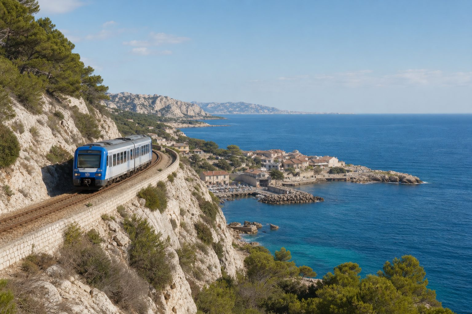
West of Marseille, the coast breaks into limestone coves, compact ports, pine slopes, and mistral-exposed headlands. The local TER to Miramas threads through on viaducts and in tunnels, keeping the sea in view while roads turn inland. It is public transport first and panoramic excursion second.
The Côte Bleue line is not a hop-on, hop-off attraction. Trains can be separated by long gaps, smaller stations have few facilities, and forest paths may close because of fire risk. Use the timetable as a spine: choose one substantial stop and one easy second stop, then leave a margin for Marseille.
Why this railway changes the coastline
Take a TER from Marseille-Saint-Charles toward Miramas via Port-de-Bouc, checking that the service calls at Niolon, La Redonne-Ensuès, Carry-le-Rouet, or Sausset-les-Pins. Miramas can also be reached by inland routes, so the destination alone is not sufficient. SNCF’s journey planner is the final authority on the day.
The railway was constructed between 1907 and 1915, with major structures designed by engineer Paul Séjourné. Beyond L’Estaque, it clings to the Nerthe range through tunnels, viaducts, and calanques. SNCF describes a 60-kilometre Marseille–Miramas route, including 32 kilometres of coves and beaches.
Sit on the left leaving Marseille and the right returning. Seats are not reserved, so board early without occupying extra places. Port infrastructure and the broad Marseille roadstead give way to L’Estaque, then rougher topography.
Plan backward from the last useful train
Save the day’s departures in both directions. Note the last two acceptable trains from every intended stop, not only the final service. Screenshots help where reception weakens.
SNCF currently offers a Pass Côte Bleue for unlimited same-day TER travel between Marseille and Miramas: €10 for one person or €15 for two travelling together. Check the product’s validity and purchase instructions before boarding, because fare conditions can change. A standard return ticket may be simpler for a day with only one stop.
Three plans are realistic. For landscape, pair Niolon with lunch and a waterfront walk at Carry-le-Rouet. For swimming, choose Carry and Sausset-les-Pins. For art history, combine L’Estaque with one coastal station. Five stops in one day produce more platform time than coast.
Facilities should decide a close call. Niolon and La Redonne reward steep walking but have limited shade, toilets, and opening hours near the platforms. Carry and Sausset provide a broader choice of food and flatter waterfront space. Travelers with reduced mobility should verify station access individually; a short rail journey does not imply a step-free route to the sea.
L’Estaque is the threshold, not a prelude
L’Estaque remains within Marseille, but it is the line’s cultural hinge. Cézanne repeatedly painted its bay and industrializing shore; Braque’s work here contributed to Cubism. The Chemin des Peintres uses ceramic panels to connect viewpoints with works made in the district.
The station and waterfront are separate, so check the walk or local bus. Allow around two hours for the painters’ circuit. At the port, panisses—fried pieces of chickpea batter—are the characteristic local snack.
L’Estaque works especially well on the return. The rail views are strongest in the morning, while an early evening stop here leaves more alternative urban transport if a coastal train changes. It also restores Marseille to the story: the Côte Bleue was never an isolated resort strip but a recreation coast reached by workers and families from the city.
Niolon and La Redonne demand a choice
Niolon supplies the line’s defining composition. The station stands about 40 metres above the sea; below it, a small harbour sits under the railway viaduct. The descent is short but steep enough to make the return time consequential. Walk under the structure, look back from public paths, and keep clear of rails, tunnel mouths, and fenced railway land.
A marked circuit links the station area, Calanque de Niolon, La Vesse, and views toward the 19th-century fort, which is closed. Use a current route description, carry water, and allow for the climb back. Swim only where permitted and when seas are calm.
La Redonne-Ensuès opens onto La Redonne, Les Figuières, and the Méjean area. Roads branch, gradients accumulate, and the coastal route toward Niolon is long and rugged. Do not improvise a through-hike because the stations look adjacent. Explore one cove and return to the same station.
From June 1 through September 30, the Bouches-du-Rhône prefecture regulates access to forest massifs daily according to heat, wind, and vegetation dryness. The next day’s map is normally published around 6 p.m. A red or closed sector cancels the hike, even if trains are operating.
Carry and Sausset make the flexible finish
Carry-le-Rouet is the easiest place to convert a rail excursion into an unhurried afternoon. The port is less than a ten-minute walk downhill from the station on a shaded pedestrian route. Restaurants, coves, and a more developed waterfront make it a useful lunch stop when Niolon’s limited businesses are closed or full.
For a modest walk, the four-kilometre interpreted Sentier du Lézard begins near the end of Quai Malleville and heads toward Sausset-les-Pins. It explains coastal plants, geology, and marine life. Confirm that it is open and calculate the return walk against the train.
Sausset-les-Pins has a harbour promenade and a five-kilometre developed corniche section associated with the GR51. It suits travelers prioritizing a level waterfront, a swim, or a meal over cliff paths. La Couronne, farther west, serves larger beaches including Verdon, but adding it makes sense only when the timetable provides a clean return.
Swimming conditions vary from sheltered beach to rocky cove. Use established access points, observe local flags and signs, and keep a wind change in view: the mistral can roughen open water quickly. A mask is useful in calm water, but footwear matters more on limestone and pebble entries. Do not jump from harbour walls or railway structures.
Martigues, with canals and historic quarters, is not a quick platform stop. Its station requires an onward bus plan. Save it for a separate day unless the purpose is to ride the whole railway.
Practical brief
Best season: April to June and September to October offer comfortable walking temperatures and good daylight. July and August suit swimming but bring heat, crowding, and daily fire-access controls. Strong mistral winds can affect comfort and service in any season.
Duration: Eight to ten hours for two stops; four to six hours for one port and the return ride. Keep at least one backup departure in hand.
Transport: TER Marseille-Saint-Charles–Miramas via Port-de-Bouc. Confirm live schedules, stop patterns, engineering works, and disruptions through SNCF TER Sud. Sit left outbound for the principal sea views.
Budget range: €20–65 per person for the day, covering the rail pass or tickets, a simple lunch, water, and a café stop. Activities such as boat trips or equipment rental sit outside that range.
Carry: Shoes with grip, at least 1.5 litres of water per walker in warm weather, sun protection, a wind layer, swim shoes, downloaded maps, and train screenshots. Check the official fire-access map before any trail.
Source note
Service, fares, and stops were checked against SNCF TER Sud’s Côte Bleue page. Historical and walking context comes from the Marseille Tourist Office guides to the Côte Bleue, L’Estaque and its painters, and Niolon. Summer restrictions were checked against the Bouches-du-Rhône prefecture’s forest-access guidance. Timetables, fares, trail status, and fire closures can change at short notice.