
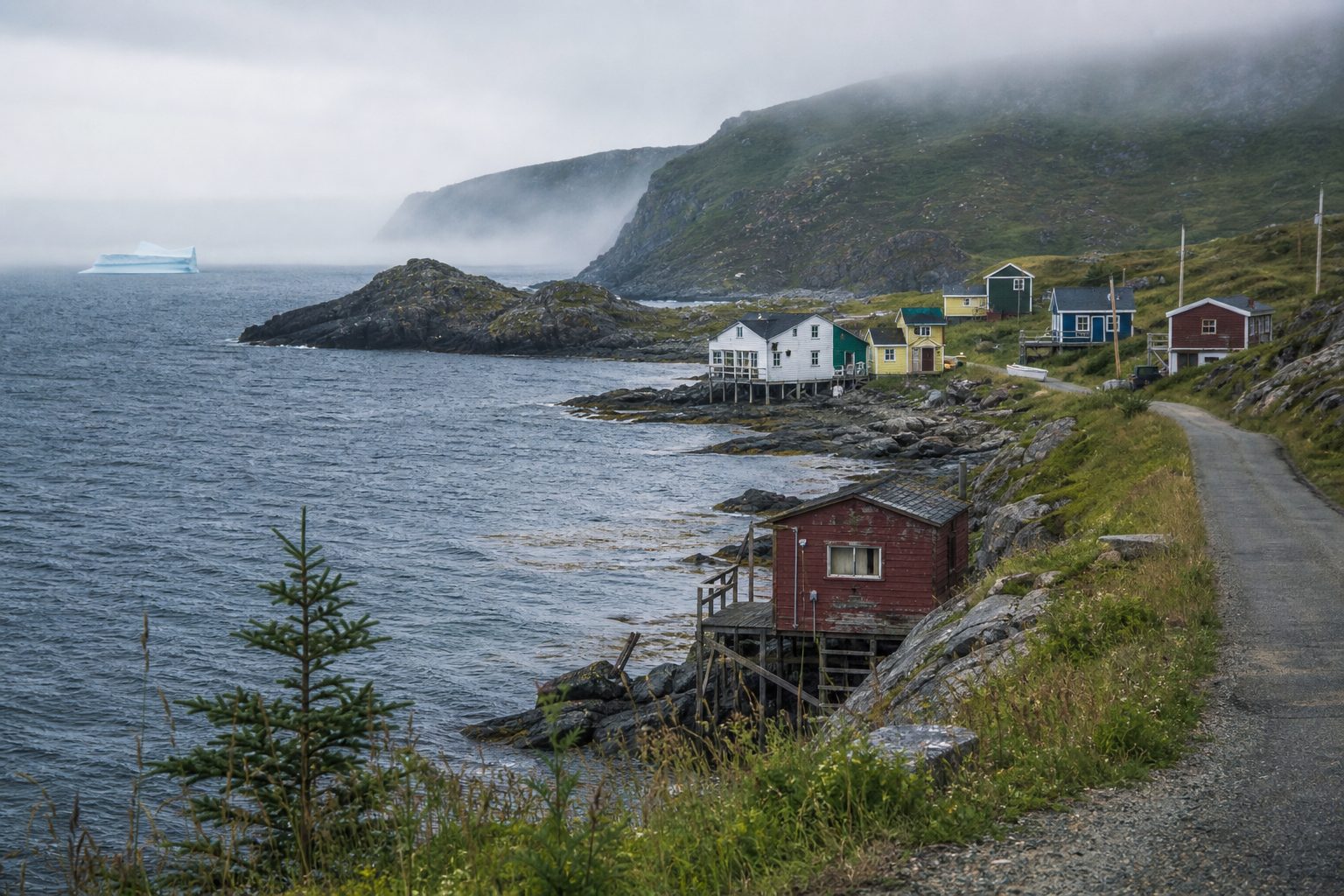
The Bonavista Peninsula is often compressed into a checklist: clapboard houses, puffins, an iceberg if fortune allows. The road offers a better structure. Newfoundland and Labrador’s Discovery Trail makes a roughly 425-kilometre circuit from Clarenville or Port Blandford, linking communities built around sheltered water.
Five days allows two readings of the peninsula. Trinity and Port Rexton explain the network of Trinity Bay; Bonavista, Elliston, and Port Union face the exposed northeast coast. “Outport” historically describes a coastal settlement outside St. John’s, commonly dependent on the fishery and once reached more naturally by sea. These remain real towns negotiating seasonal work, changing fisheries, and limited services.
Build a loop with two bases
Enter at Clarenville on Route 230 and spend two nights around Trinity or Port Rexton, then two around Bonavista or Elliston. On day five, take Route 235 south and rejoin the Trans-Canada Highway through Route 233 at Port Blandford. This leaves room to move exposed-coast plans around bad weather.
Distances look small, but roads pass through communities, fog reduces visibility, and stops sit at the ends of local spurs. Keep the tank above half full, download a map, and use the provincial 511 service. Do not rely on late meals; many businesses operate seasonally.
Clockwise is useful because Clarenville is the last large service centre before Trinity; buy hiking food and essentials there.
Treat wildlife and iceberg outings as movable pieces, not the route’s foundation. Sightings depend on season, wind, visibility, and ocean conditions. Boat tours operate seasonally and can cancel for weather; read the operator’s cancellation terms and preserve a shore-based alternative. Even in July, sea fog can erase a headland while the next harbour remains clear.
Day one: Trinity’s working architecture
Turn from Route 230 onto Route 239 for Trinity. Its saltbox houses, churches, stores, forge, and cooperage make sense when connected to the harbour. This was a fishing and trading centre where merchants supplied crews and exported salt cod. Begin with the historic sites or a guided walk.
Allow an afternoon on foot. Opening hours determine the pace. Across the harbour, Fort Point was fortified by the British in 1748 and gained a lighthouse in 1871. It requires a separate drive; save it for clear weather.
Trinity Bight comprises 11 communities, including Trinity East, Port Rexton, Champney’s, English Harbour, and New Bonaventure. Avoid blocking narrow roads or private stages—the waterfront structures used for handling fish and gear. Harbour edges may still be working or residential space.
Day two: Walk the edge at Port Rexton
Use the morning for the Skerwink Trail, a 5.3-kilometre coastal loop beginning in Trinity East near Port Rexton. The official Hike Discovery listing grades it moderate to difficult. Expect roots, stairs, steep cliff-side ground, and sections that become slick after rain. The sea stacks and views across to Trinity are the fixed attractions; whales, eagles, icebergs, and seabirds are seasonal possibilities, never scheduled features.
Set aside two to three hours. Carry water and a windproof layer. Stay behind barriers and back from cliff edges: erosion and gusts make an informal photo step a poor trade. In fog, hard rain, or high wind, substitute a shorter walk or indoor site.
Spend the afternoon in one smaller Bight community. Champney’s West and English Harbour offer harbour walks when facilities are open. New Bonaventure’s Random Passage is a reconstructed early-19th-century fishing settlement made for television, useful as interpretation but not an intact historic village.
Days three and four: Bonavista, Elliston, Port Union
Move north to Ryan Premises National Historic Site in Bonavista. Its five principal buildings formed merchant James Ryan’s headquarters and now interpret 500 years of the East Coast fishery, from curing and trade to sealing and household life. In 2026, exhibits are scheduled to open daily from June 1 through October 9.
Continue to Cape Bonavista Lighthouse and Dungeon Provincial Park, where a collapsed sea cave is viewed from exposed ground above. Wind and fog change quickly; keep the order flexible.
Back in Bonavista, park once and walk the older harbour streets. The spacing of merchants’ premises, churches, houses, and fishing stages is easier to understand at walking speed. Leave driveways and wharf approaches clear, and use the town’s public waterfront areas rather than assuming every path to the water is communal.
Devote day four to Elliston and Port Union. Elliston’s earth-insulated root cellars moderated winter cold and summer warmth; hundreds survive, some still in use. The land-based puffin site faces a nesting island. Birds come ashore during breeding season, but proximity varies. Use binoculars and stay on the path.
At Port Union, the story shifts to organized labour. The Fishermen’s Protective Union began building under William Coaker in 1916. Its industrial buildings, workers’ housing, and plan form a National Historic District and Canada’s only town founded by a union. Observe nearby Ediacaran fossils without touching or collecting.
Day five: Route 235 and the less-edited coast
Leave with a full tank and follow Route 235 past King’s Cove, Keels, and the turnoff for Open Hall, Red Cliff, and Tickle Cove. Services are sparse; the reward is a sequence of harbours, headlands, fishing premises, and geological exposures.
Keels is a designated stop within the Discovery UNESCO Global Geopark. Its “Devil’s Footprints” are natural markings in red sandstone, not tracks in the literal sense. At Tickle Cove, a sea arch is another official geosite, but coastal conditions and access should be checked locally. The geopark protects and interprets a coastline containing evidence from deep geological time, including Ediacaran fossils more than half a billion years old.
Use pull-offs; never stop in a traffic lane for a photograph. Ask before entering a wharf. Connect to Route 233 for Port Blandford and the Trans-Canada Highway. Allow extra time, and place any fixed ferry or flight connection on day six.
Practical brief
Best season: Mid-June through September offers the broadest range of open sites, tours, restaurants, and snow-free trails. Icebergs are more likely earlier and whales later in that window, but neither is guaranteed. September is quieter; shortening daylight and reduced business hours require planning.
Duration: Five days and four nights on the peninsula. Add one night near Clarenville or Port Blandford if the trip connects to a fixed departure elsewhere in Newfoundland.
Transport: A car is effectively essential. Allow roughly 425 kilometres for the official loop, plus local lighthouse and harbour spurs. Fuel in Clarenville, Bonavista, or whenever a reliable station appears.
Budget range: C$190–360 per person per day for two people sharing a room and rental car, including meals, fuel, and admissions. July and August lodging can exceed this range; simple guesthouses and self-catering reduce food costs.
Carry: Waterproof shell, warm mid-layer, sturdy footwear, binoculars, water, snacks, and offline directions. Check 511 Newfoundland and Labrador each morning and confirm seasonal attraction hours directly.
Source note
Route and factual reporting were checked against Newfoundland and Labrador Tourism’s Discovery Trail and Trinity and Port Rexton guide, the official Skerwink Trail listing, Parks Canada’s Ryan Premises visitor information, and the Canadian Register of Historic Places entry for the Port Union Historic District. Seasonal hours, trail conditions, wildlife presence, and road access should be rechecked before departure.